
Nova Scotia · Ontario · British Columbia
Know the ground before you walk it.
Live mineral claim maps, the geoscience underneath them, and the tools to stake and hold ground — in one app built for prospectors.
Free to download. Pro is optional — the map, the layers and the claim data are not behind it.

What it does
Five government viewers, one map.
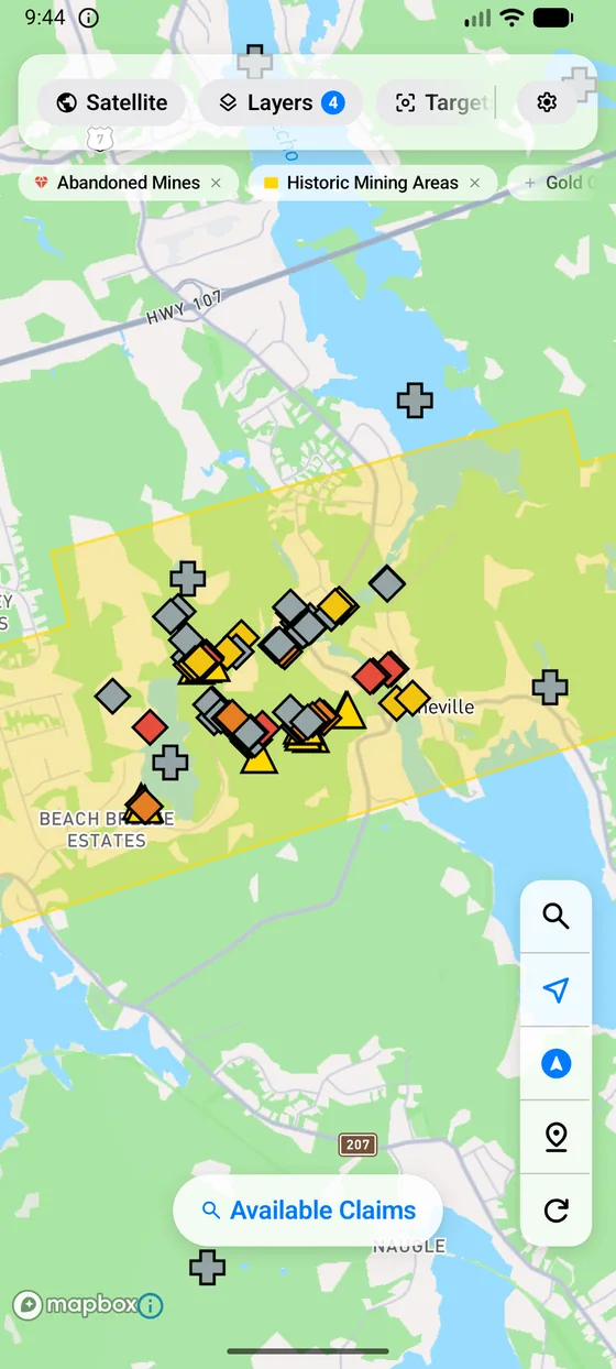
Claim boundaries in one portal, occurrences in another, drill holes in a third, geology in a fourth, and the staking grid somewhere else again. Canada Prospector puts them on the same screen — and tells you what is under your finger.
Explore the ground
Live claim fabric for all three provinces with holders, expiry dates and tenure history. Mineral occurrences, abandoned mines, drill holes, bedrock and surficial geology, faults and glacial ice-flow directions.
Find opportunity
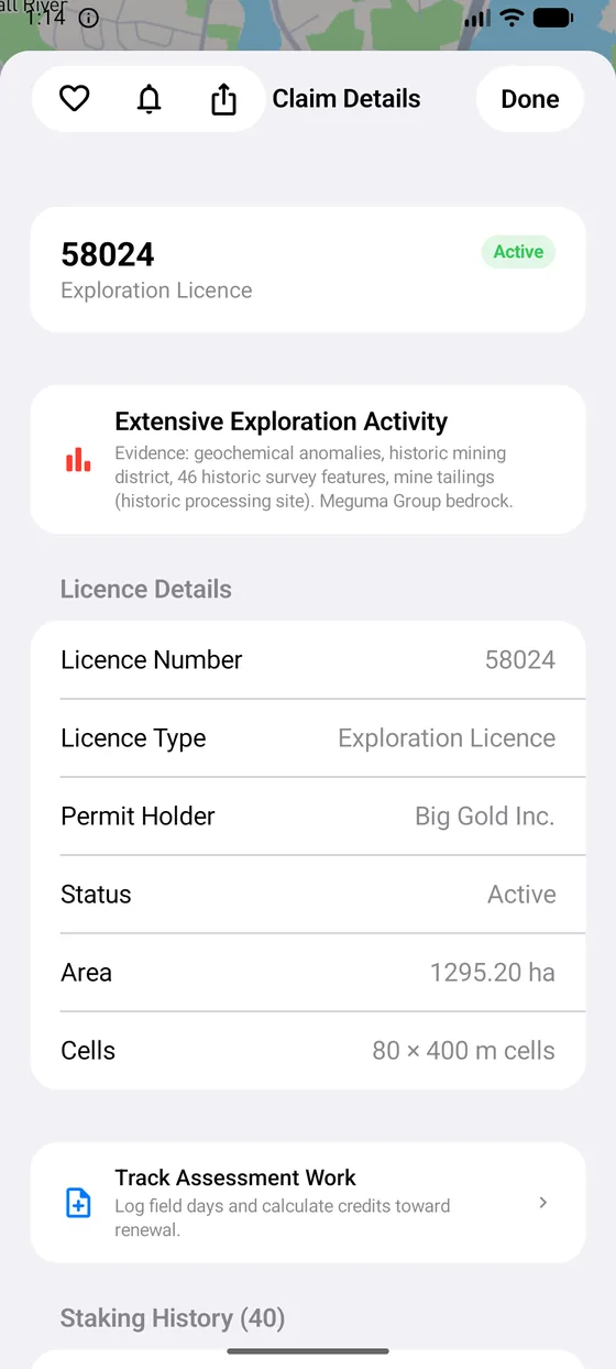
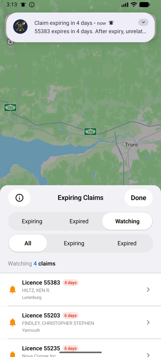
See which claims lapse soon and watch the ones you care about. Ranked exploration targets with an open-ground check. Tap anywhere for an instant read of the geology, workings and claims beneath it.
Stake it
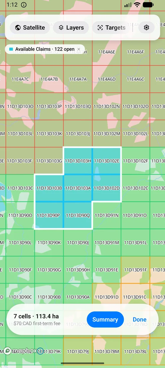
Frame an area, pick coterminous cells under your province's own rules, price the application, and read the cells off in the registry's format — ready to paste into NovaROC, MLAS or Mineral Titles Online.
Do the work
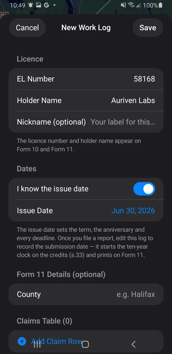
An assessment-work tracker built for each province's regime — Nova Scotia's licence terms, Ontario's unit credits with receipts, BC's hectare requirements — and filled government PDFs to file.
Work without a signal
Download a province's data pack and your map area before you leave. The geology, the workings and your saved ground stay with you where the cell service stops.
Take it with you
Save favourites, drop field pins and notes, and export to KML, GeoJSON or CSV for Google Earth, QGIS or a partner. Your research doesn't stay locked in the app.
In the field
Built for a phone in a wet glove.
Every screen below is the real app. Swipe through.
Three provinces, three regimes
Each province gets its own rules — not a rename of someone else's.
Tenure works differently in each jurisdiction, so the app's guidance, fees, staking rules and assessment-work maths are written per province against the actual regulations. A claim sheet in British Columbia never tells you to file in Nova Scotia.
Exploration licences & claims
The 16.2-hectare claim grid, NovaROC tract descriptions, licence terms and person-day assessment credits — plus the Faribault 1898–1919 gold-district survey, which isn't on any government viewer.
- Registry
- NovaROC
- Assessment
- Credits per claim, per two-year term
Cell claims & unit credits
The MLAS cell grid, Geology Ontario's mapping, AMIS and OMEIS records, the provincial hillshade — and O. Reg. 65/18's receipted assessment work, organised into field programmes with a cost-summary export.
- Registry
- MLAS
- Assessment
- Receipted costs against per-claim units
Mineral titles & hectare work
Mineral Titles Online tenures over the BCGW fabric, MINFILE showings, and BC's hectare-based work requirements — with a Statement of Work summary ready for the MTO filing.
- Registry
- Mineral Titles Online
- Assessment
- Work value per hectare, per year
Canada Prospector Pro
The map is free. Pro is the edge.
Claim boundaries, the geoscience layers, the "what's here" tap and the staking grid are in the free app. Pro is for the work that comes after you've found something worth chasing.
- Prospecting TargetsRanked locations where multiple independent data sources converge — with an open-ground check, so you go to the field knowing rather than guessing.
- Claim AssessmentEverything recorded inside a claim boundary in one tap, instead of opening five separate government viewers.
- Claim Watch & alertsReminders at 90, 30, 7 and 1 day before a claim expires — and a push the morning ground opens inside an area you're watching.
- Expiring ClaimsA province-wide list of claims about to open up, scored against the geoscience underneath them.
- Assessment Work TrackerLog field days, watch credits build, and export the province's real government forms filled in and ready to file.
- Staking HistoryWho staked a cell before you and what they were after — the chain of title from the provincial registry, before you commit.
- Faribault 1898–1919 SurveyNova Scotia's gold districts as the old-timers mapped them — shafts, veins and workings that aren't on any government viewer.
- Export & offlineKML, GeoJSON and CSV out; full data layers offline; unlimited saves and field notes.
Where the data comes from
Public data, plainly credited.
Canada Prospector reads each province's own public registry and open geoscience data, and renders maps with Mapbox. Some layers are live from the registry; others ship as a dated snapshot so they work with no signal — the app tells you which is which, and when a snapshot was taken.
| Province | Tenure | Geoscience |
|---|---|---|
| Nova Scotia | NovaROC registry | NS Department of Natural Resources geoscience data |
| Ontario | MLAS | Geology Ontario / OGS, AMIS, OMEIS |
| British Columbia | Mineral Titles Online | BC Geographic Warehouse, MINFILE |
This app is not the registry. Canada Prospector is an independent tool and is not affiliated with or endorsed by any provincial government. Tenure changes daily, published data lags, and claim boundaries are approximate. Before you stake, file or spend money, confirm it directly with the province's registry. Nothing in the app is legal or financial advice.
Get the ground under you.
Canada Prospector is finishing store review on both platforms. The links here go live the day it does.
Questions before then? Get in touch.